

Peter's Model Railroading | The Layout | Hazel Mine, Canonsburg, PA - Module #4
Design #4

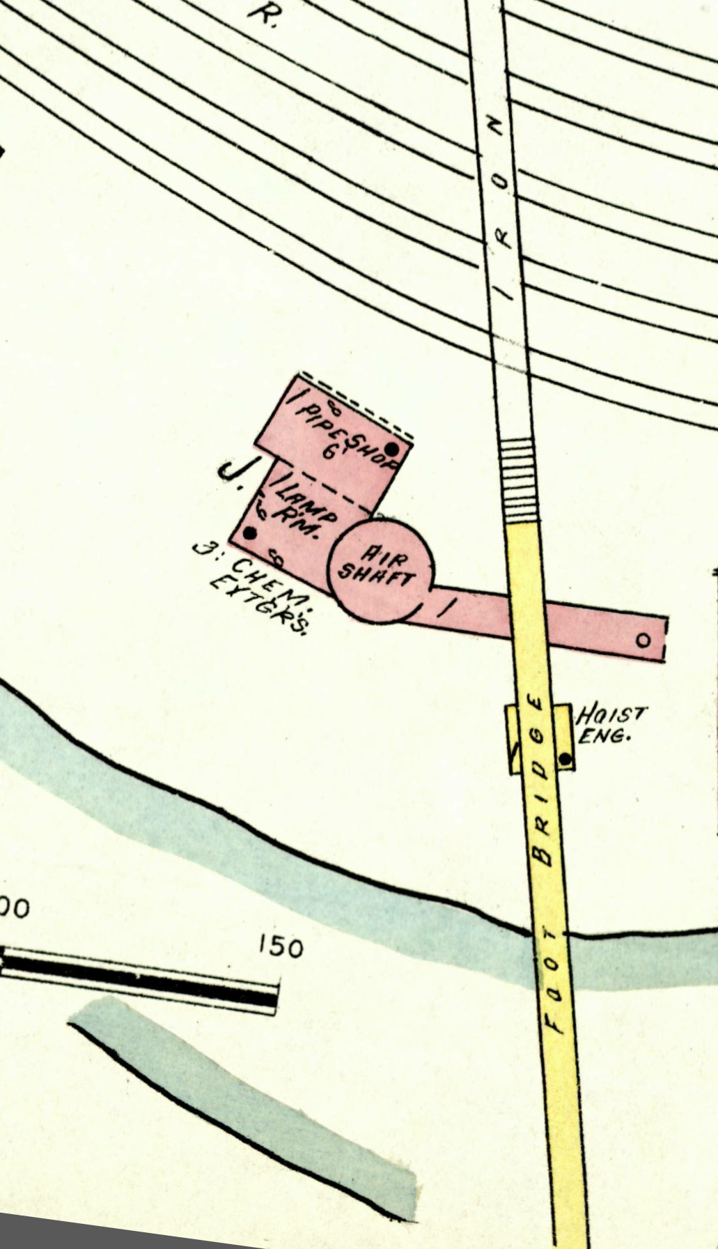
I wanted to complete the planned schematic of the 4-module layout, so this is the region of the Sanborn map that this fourth module is to cover. This will be the right-most module. The diagram is "upsidedown" from how I am modeling it, i.e. the tracks are going to be on the front side of the layout. The five yard tracks curve quite dramatically toward the tipple on the right, and toward the front of the layout.
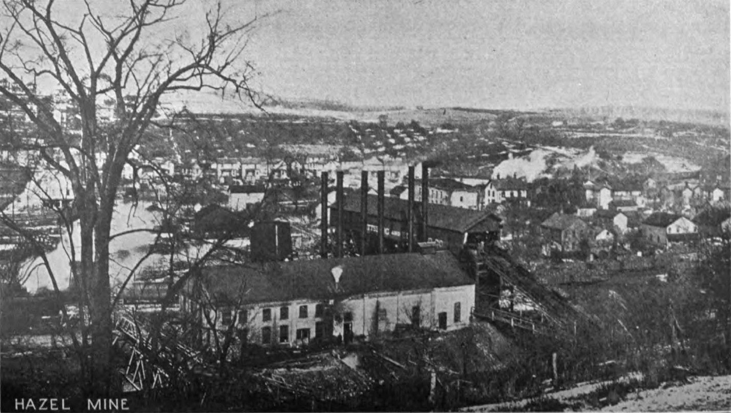
The most interesting feature is the very long walkway, marked the "foot bridge". It has stairs just above the first yard track (in the diagram), spans the entire yard, spans a good bit of "land", spans the entire Chartiers creek, and (speculation) goes into the mine. I have this scan of one photo, taken from Buffalo Hill, which is the hill on the other side of the creek (not visible at the bottom of the diagram), which shows, through some trees, the foot bridge. Behind the large tree on the left is some white smoke. This smoke might be coming from the "Air Shaft" marked on the Sanborn map. It is clearly winter time in the photo, so that hot air from the mine's ventilation may be causing the air to be visible. I have no photos of the "Air Shaft", "Lamp Room", or "Pipe Shop" marked on the map. There are another set of stairs on the foot bridge after it crossed the tracks. The photo seems to show the bridge over the creek to be lower, so I suspect those stairs come down. Behind the steam another style of bridge is visible, which I presume is the bridge section over the tracks. It looks to be of a different construction from the section going over the creek. The bridge doesn't appear anywhere else that I have found, and it is definitely not there in later photos, so it must have been removed at some point. Either way, I can't wait to build that model; it will be 48" in actual length, i.e. the entire depth of my module.